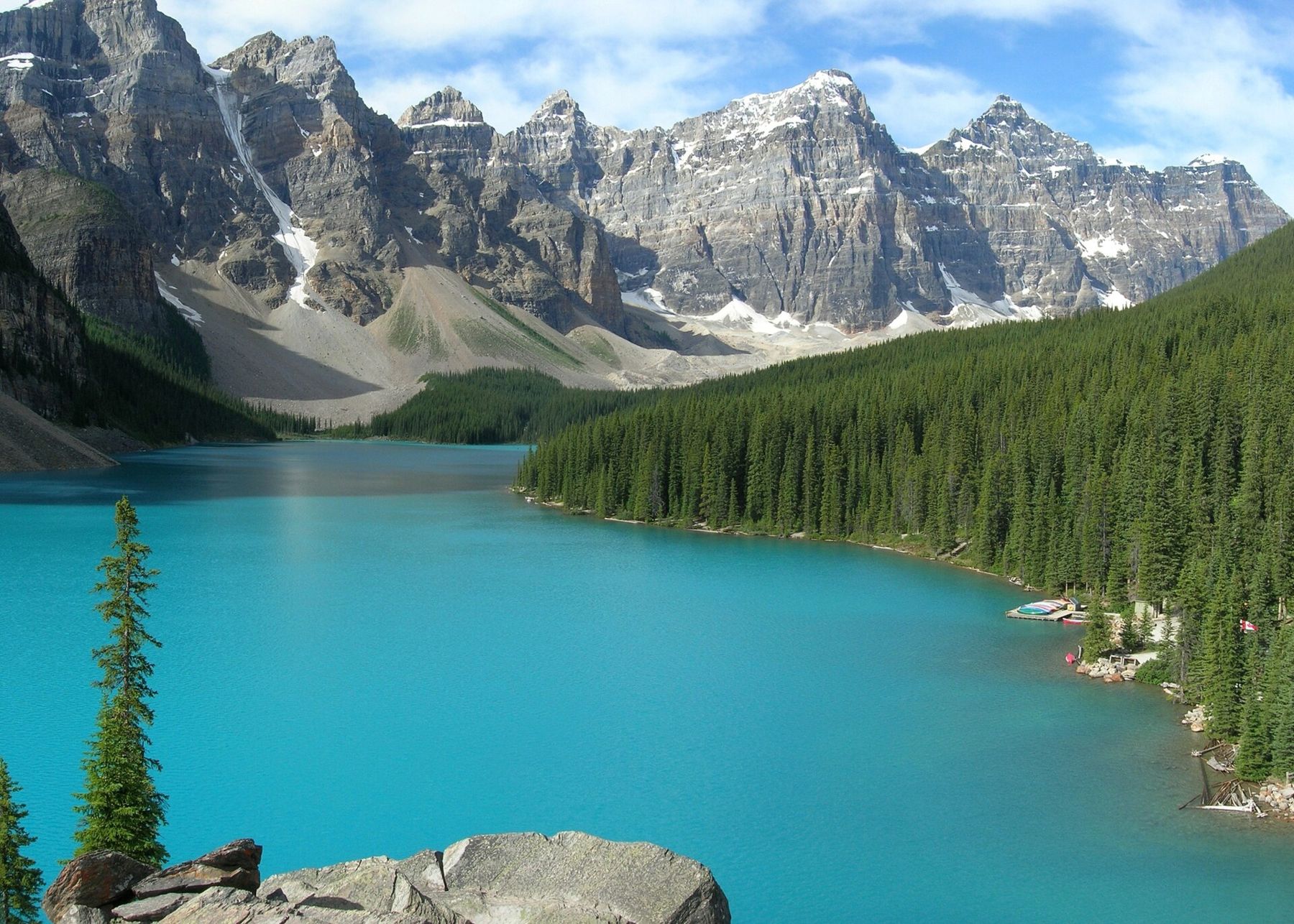
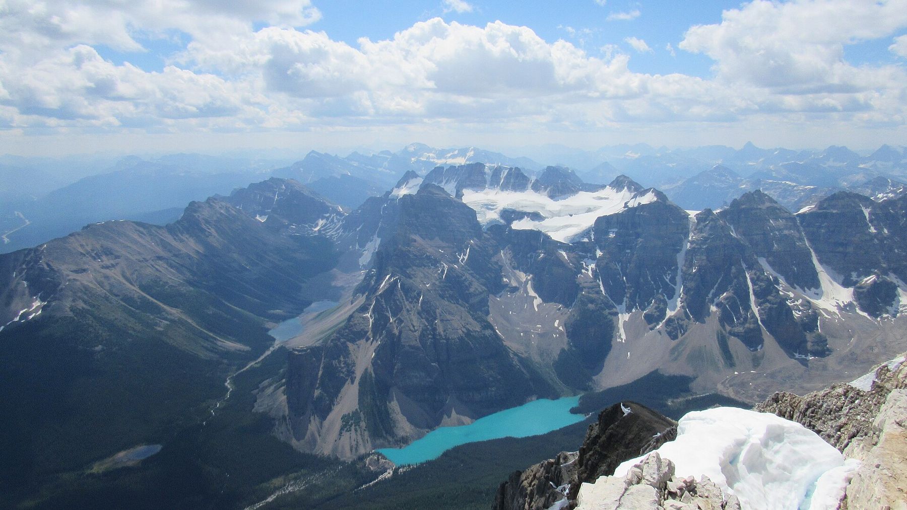
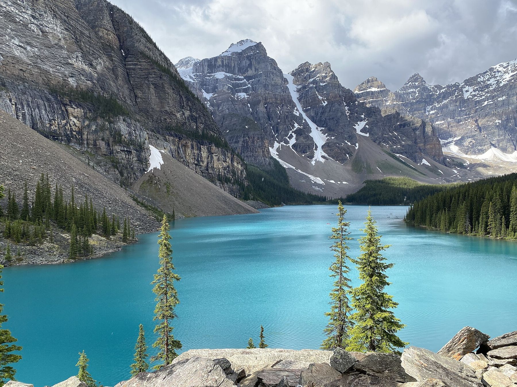
Lake Louise and Moraine Lake are the postcard lakes of the Canadian Rockies. Lake Louise lies at the foot of a cirque of peaks with the Victoria Glacier hanging at its far end, its water a milky jade. Moraine Lake, a few kilometres away in the Valley of the Ten Peaks, is smaller, higher and even more vivid, a bright blue pool below a wall of jagged summits. For decades, both were reached by car in a few minutes from the village of Lake Louise.
That has changed. Parking at both lakes fills before dawn in summer, and traffic jams on the access roads became so bad that Parks Canada closed the road to Moraine Lake to private vehicles. Seeing the lakes now takes a little planning, but the rewards are the same.
Moraine Lake Road and the shuttles
Moraine Lake Road, which climbs about 12 km from the Lake Louise area to the lake, is closed to personal vehicles. Access is by Parks Canada shuttle buses, which run from a park-and-ride lot near the village in summer and early autumn, or by licensed commercial buses. Cyclists may use the road. The shuttles need to be reserved in advance, and seats for the early morning departures go quickly. Schedules, prices and booking rules change from year to year; check the current arrangements before you go.
The road usually opens in early June, depending on snow and avalanche conditions, and closes in October. Outside that season, there is no access to Moraine Lake except on skis or snowshoes, and the area is exposed to avalanche danger.
Lake Louise: the shore and the parking
Lake Louise is still reachable by car, but the parking lot at the lakeshore is paid, limited and usually full very early in the morning from late spring to autumn. Parks Canada shuttles also run to Lake Louise from the park-and-ride, and many visitors combine both lakes on a shuttle connector. Arriving before sunrise is the only reliable way to park.
The shore walk along the north side of the lake is flat and easy, and leads in about 2 km to the far end below the glacier and the cliffs. Canoes are rented in summer from the boathouse; the water is very cold, and anyone who falls in faces serious danger within minutes.
For a view from above and a little quiet, take the trail from the lakeshore up to Lake Agnes. It climbs steadily through forest for about 3.5 km, gaining around 400 metres, past the small Mirror Lake, to a hanging lake in a cirque below the peaks. A small historic teahouse at Lake Agnes, open in summer, serves tea and simple food; it is not reached by road, and supplies are carried in. From Lake Agnes, trails continue to the Big Beehive and the Little Beehive, rocky viewpoints over Lake Louise far below.
Start early: the trail is busy by mid-morning, and the teahouse has queues on summer afternoons.
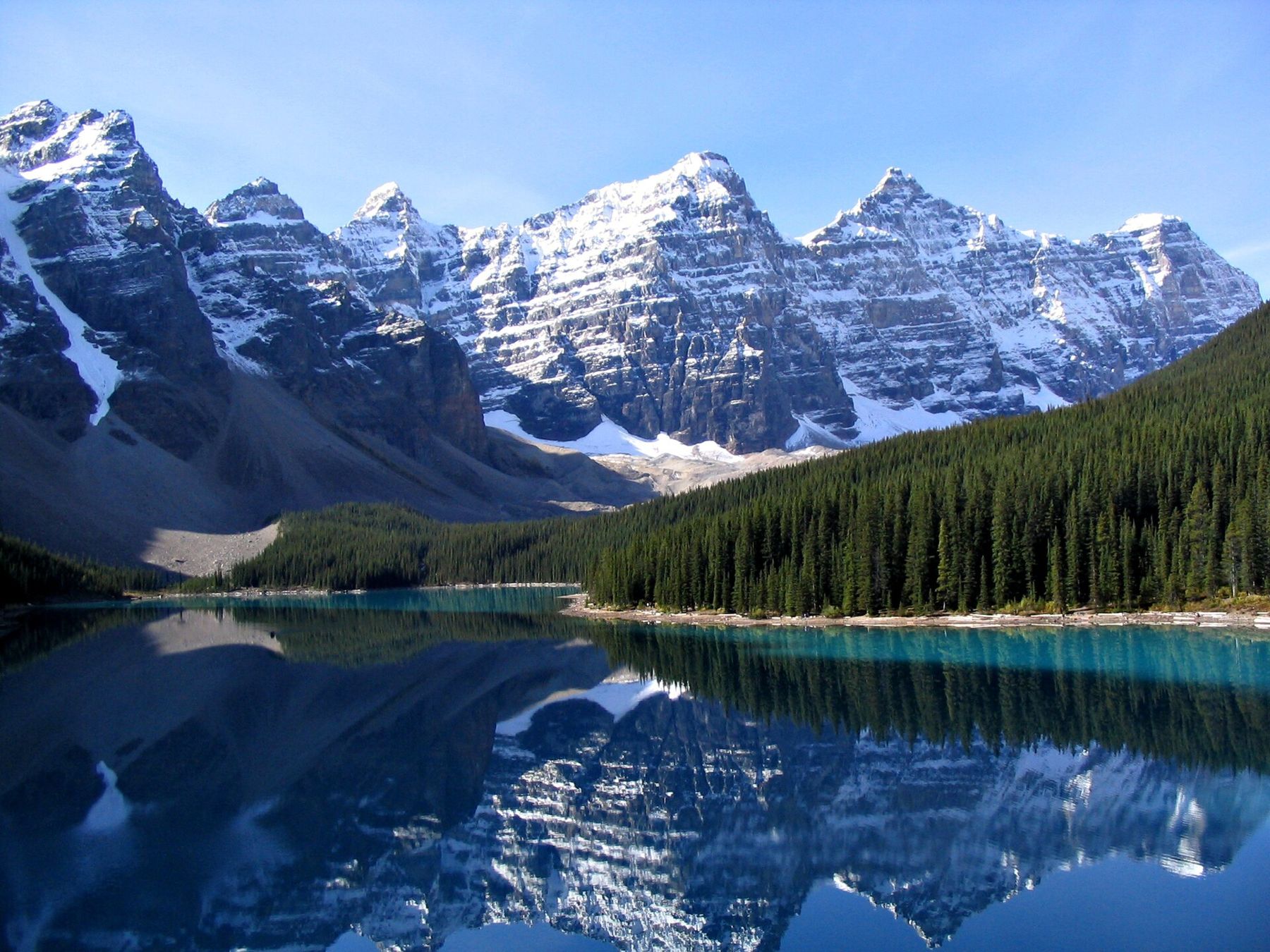
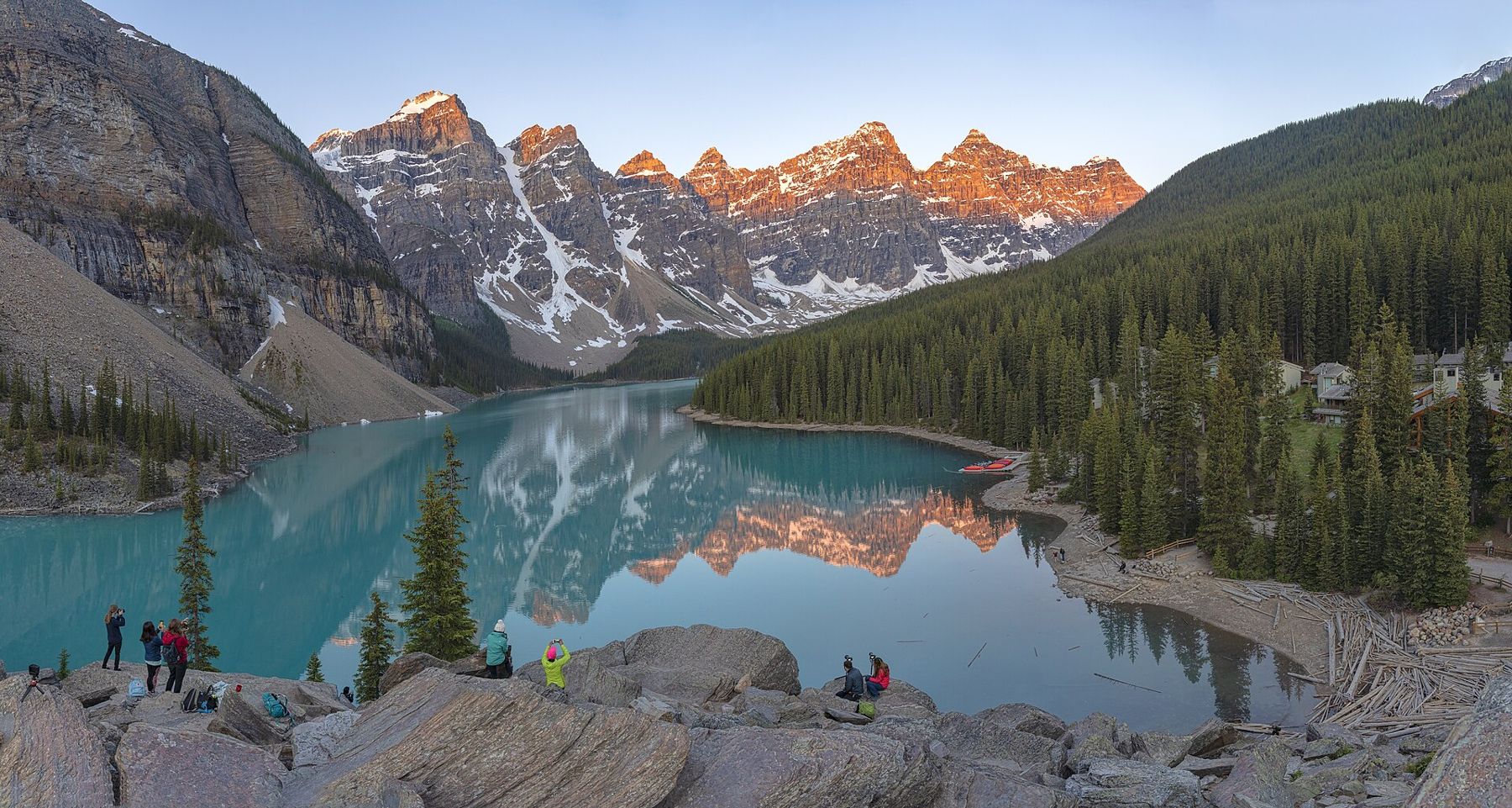
At Moraine Lake, the shuttle stops near the lakeshore. A short path climbs onto the rockpile, a heap of boulders at the outlet of the lake, which gives the famous view across the water to the Ten Peaks. It takes about ten minutes to reach the top. The view is at its best in the morning, when the sun lights the peaks and the water is still.
Also on Highway 1Banff townsite on foot, from Bow Falls to the Cave and BasinA level trail follows the lakeshore to the far end, and longer trails climb to Larch Valley and Sentinel Pass, famous for golden larches in late September. Group-hiking restrictions sometimes apply on these trails because of grizzly bears; check notices at the trailhead.
Plain of the Six Glaciers
The other classic hike from Lake Louise follows the shore to the far end of the lake and then climbs gently up the valley towards the Victoria Glacier. The Plain of the Six Glaciers trail is about 5.5 km each way, through forest and then over open moraine, with the glacier and the ice-covered peaks growing closer as you go. Another small teahouse, open in summer and reached only on foot, sits near the end of the trail. Beyond it, a path continues to a viewpoint over the glacier and its icefalls.
Avalanches thunder down from the hanging glaciers on the cliffs above, especially in the afternoon heat, and the sound echoes across the valley. Stay on the trail; the moraines are loose and unstable.
Winter at the lakes
In winter, Lake Louise freezes solid and becomes a skating rink, with cleared ice and an ice sculpture festival in some years, set against the frozen waterfall and the snowy peaks. Moraine Lake Road is closed to all vehicles in winter and becomes a cross-country ski route, though the upper part crosses avalanche terrain and is not safe without proper knowledge. Snowshoe trails lead around Lake Louise. The village is quiet, and the lakes have a different, austere beauty under snow.
Whatever the season, dress warmly: at 1,750 metres and higher, the weather around the lakes is cooler than in Banff, and snow can fall in any month.
When the colour comes
Both lakes stay frozen well into spring, often until early or mid-June, and the turquoise colour that makes them famous comes later, when glacial meltwater full of fine rock flour flows in during July and August. In early June the lakes may be white with ice or a dull grey. By September, the colour begins to soften as the melt slows.
The shoulder seasons have their own beauty, with snow on the peaks and fewer people, but if you are coming for the colours, aim for midsummer.
Seeing the lakes now takes a little planning, but the rewards are the same.
A few habits make the day easier. Bring a warm layer even in August, because the air off the water is cold before the sun clears the ridges. Carry lunch and water, since the lakeshore cafes fill quickly and the queues grow long by noon. Keep to the marked paths at the rockpile and along the shore, where the vegetation is fragile and slow to recover. Pack out everything you bring in, including fruit peels.
The village and the slow road
Lake Louise village sits beside the Trans-Canada below the lakes, with a small shopping area, a visitor centre and the railway station. From here, the Bow Valley Parkway leads back towards Banff, and Highway 93 heads north to the Icefields Parkway. Fill up with fuel here before heading north. Shuttle and parking arrangements change every season; always check the latest information from Parks Canada before you set off.