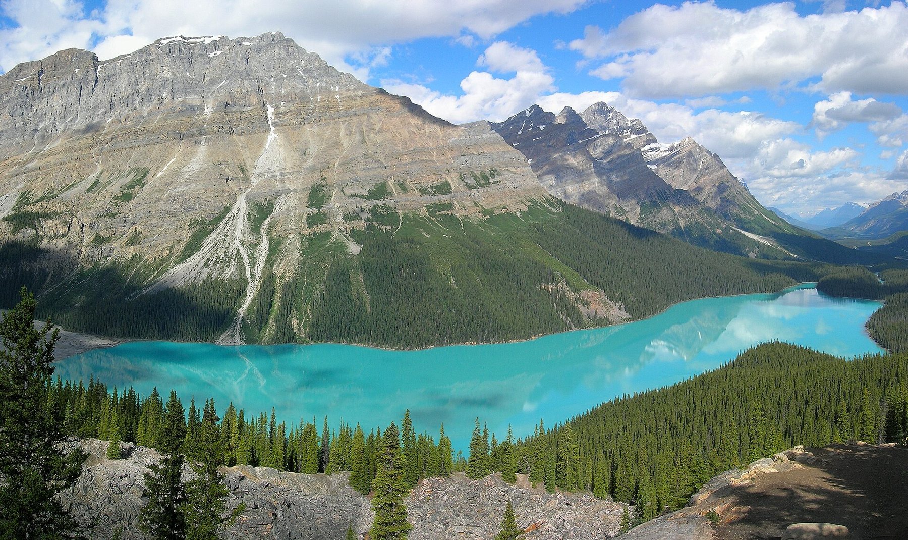
Peyto Lake lies in a deep valley just north of Bow Summit, the highest point on the Icefields Parkway. From the viewpoint above, it looks like a giant turquoise animal print laid among dark spruce, with the Mistaya Valley running away to the north. It is a view that ends up on calendars, postcards and phone screens around the world, and in summer the viewing platform shows it.
None of that makes it less worth seeing. It only means a little planning helps.
Why the water is that colour
The lake is fed by meltwater from the Peyto Glacier, part of the Wapta Icefield. As glaciers grind over bedrock they produce rock flour, particles so fine they stay suspended in the water. Those particles scatter blue and green light, which gives glacial lakes their milky turquoise. The more meltwater flowing in, the stronger the effect.
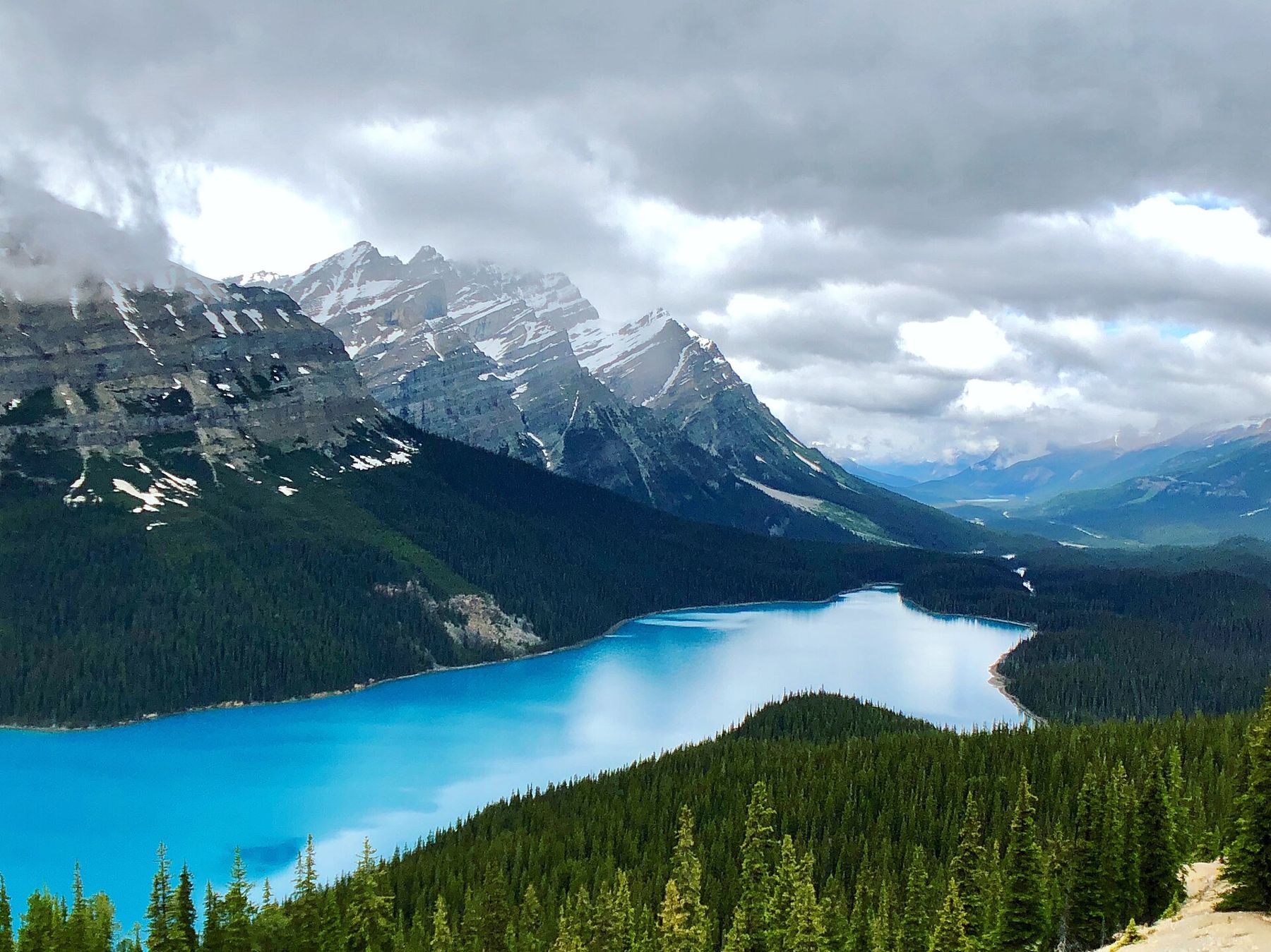
That is why the colour changes through the year. In June the lake may still be partly frozen, or grey with early melt. By July and August, with the glacier melting fast, it reaches the vivid shade in the photographs. After the first cold nights of September, the inflow drops and the colour softens.
The walk up from the car park
From the Bow Summit car park, a paved path climbs through subalpine forest to the main viewing platform. It is short, about ten to fifteen minutes uphill, but at over 2,000 metres you may notice the altitude. The path is suitable for most visitors; there is also an accessible parking area closer to the viewpoint.
The platform was rebuilt and enlarged in recent years to cope with the numbers, and it does a good job. On a summer afternoon it still feels crowded, with tour buses arriving in waves.
A quieter view, a few minutes further
The trick at Peyto is to keep walking. Paths continue uphill from the main viewpoint through stunted trees and alpine meadow, and within a few minutes the crowd thins. The upper trail climbs gently towards the higher slopes of Bow Summit, with wildflowers in late July and views both north over the lake and south towards Bow Lake.
Also on Highway 93How to drive the Icefields Parkway in one day without rushing itStay on the marked paths. The meadows here are fragile, the growing season is only a few weeks long, and footprints on soft ground last for years. The informal trails trodden down to the cliff edge in front of the platform are both damaging and dangerous; the drop is steep and the rock is loose.
Early morning is the best time for both light and peace, and the sun comes round onto the lake by mid-morning. Evening is the second-best choice, when the buses have gone and the valley fills with long shadows. Midday from July to August is the busiest time of all.
Clouds sitting low on the peaks are common, and the lake can look flat and grey under them. If the summit is fogged in, it is usually better to drive on north to the glacier and try again on the return trip than to wait.
The highest point on the road
Bow Summit is the divide between the Bow River, flowing south and east past Banff, and the Mistaya, flowing north to join the North Saskatchewan. Standing at the viewpoint, the rain that falls behind you ends up in Calgary and the rain in front of you runs towards Saskatchewan Crossing.
The altitude also means snow arrives early and leaves late. The viewpoint road and path are often under snow until June, and winter visits are a different, colder undertaking. Check conditions in the shoulder seasons before you plan around it.
Photographing the lake well
The platform faces roughly north, so the sun lights the lake from behind you for much of the morning, and the water is at its brightest between about nine and noon on a clear day. A wide lens takes in the whole lake and the valley beyond; a longer one picks out the alluvial fan at the far end, where the inflow from the glacier spreads out in braided channels and the colour is strongest.
Polarising filters can deepen the turquoise, but they can also make it look unreal. The lake does not need help. What it does need is patience on a busy day: people move in and out of the front rail every few minutes, and a spot opens if you wait.
Drones are not allowed in the national parks without a permit, and the viewpoint is no exception. Tripods are fine if you keep the walkway clear for others.
What lives up here
Bow Summit sits close to the treeline, and the forest around the viewpoint is subalpine: Engelmann spruce and subalpine fir, many of them short and twisted by wind and heavy snow. Clark's nutcrackers and grey jays often appear around the platform looking for food. Do not feed them; human food harms them and teaches them habits that end badly.
Hoary marmots and pikas live in the rocky slopes higher up the summit trail, and their whistles and squeaks are often heard before the animals are seen. Grizzly and black bears also use these meadows, especially in late summer when berries ripen, so keep an eye out on the upper paths and carry bear spray if you go beyond the main viewpoint.
Bow Lake below, Mistaya beyond
Bow Lake is four kilometres south, and the two make a natural pair: one at water level, one from above. Mistaya Canyon and the Waterfowl Lakes lie a few kilometres north, so Peyto fits easily into a slow morning on the southern half of the parkway before lunch at Saskatchewan Crossing.