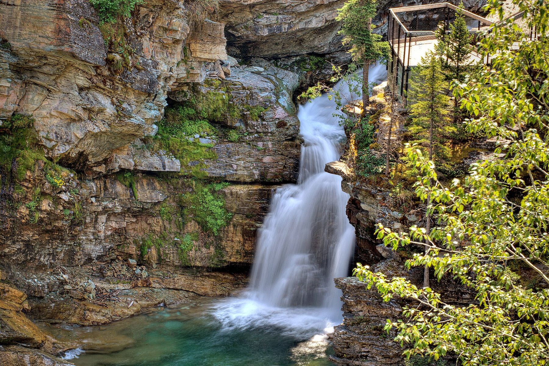
Most visitors to Waterton Lakes National Park drive straight to the townsite on the lake. Just inside the park gate, a narrower road turns off to the west and climbs up the Blakiston Valley. This is the Red Rock Parkway, about 15 km long, and it ends at Red Rock Canyon, a short gorge cut through rock coloured deep red and pale green. Along the way, the road crosses open grassland where the prairie meets the mountains, then climbs into the valley with views of high peaks on both sides.
The drive is short and the canyon is small, but the combination of colour, landscape and wildlife makes it one of the most rewarding side trips in the park.
Prairie, then mountains
The first part of the parkway crosses rolling grassland, part of the narrow strip of prairie that runs right up to the mountains in Waterton. In June, these meadows are full of wildflowers, among the richest displays in the Canadian Rockies. Black bears and grizzlies often feed on the slopes, especially when berries ripen in late summer. Elk, deer and coyotes are common.
As the road climbs, the valley narrows and the peaks close in. Mount Blakiston, the highest mountain in the park, rises to the south, and the creek runs below the road in a wide gravel bed.
The 2017 fire
In September 2017, the Kenow wildfire swept through the Blakiston Valley and much of the park. It burned the forest along the parkway almost completely, along with the facilities at Red Rock Canyon. The road was closed for several years while it was repaired and the area was made safe.
Today the drive passes through slopes of standing dead trees, silver-grey against the sky, with a carpet of new growth beneath them. Fireweed, with its tall spikes of pink flowers, is one of the first plants to return after fire, and in summer the burned slopes glow with it. Young lodgepole pines, whose cones open in the heat of a fire, are already growing thickly. Watching the forest regrow is part of the interest of the drive now.
At the end of the parkway, a short loop trail follows the rim of Red Rock Canyon. The canyon is shallow and narrow, cut by Red Rock Creek through layers of ancient sedimentary rock. The rock is mostly argillite, a hardened mudstone, and its colours come from iron. Where the iron was exposed to oxygen when the sediment was laid down, it oxidised and turned the rock red, like rust. Where there was little oxygen, it stayed in a different form and gave the rock a green tint.
The layers are some of the oldest rocks visible in the Rockies, more than a billion years old. Look for ripple marks and mud cracks preserved in them, left by water and drying mud on an ancient shoreline.
Also on Highway 5Waterton, where the prairie runs straight into the peaksThe loop around the canyon takes about half an hour. In summer, the creek is shallow, and people paddle in the water below the canyon. Be careful on the wet rock.
Blakiston Falls
From the canyon, a trail crosses the creek and leads about 1 km through the burned forest to Blakiston Falls, a series of cascades on Blakiston Creek. Viewing platforms overlook the falls. The walk is easy and mostly level, and it takes about an hour there and back. Longer trails continue up the valley into the backcountry for experienced hikers.
Bison, wildflowers and the drive back
On the way to or from the parkway, the bison paddock road near the park entrance loops through grassland where a small herd of plains bison grazes, with the mountains rising behind. The animals are often close to the road. Stay in your car; bison are large, fast and unpredictable.
The drive back down the parkway, with the prairie opening ahead and the peaks behind, is as good as the drive up. In the evening, the low sun lights the grasslands gold and brings deer and elk out to feed. Take it slowly.
In early summer, look for the wildflowers along the lower parkway. Waterton is famous for them: arrowleaf balsamroot covers the slopes in yellow, lupines in blue and purple, and the prairie grasses are full of smaller flowers. Stay on the road edges and trails, and do not pick them.
Reading the rock on the canyon rim
The canyon walls show thin layers of red and green rock stacked like pages in a book, each one a layer of mud deposited in shallow water long before there were plants or animals on land. In places the layers show ripple marks, wavy ridges left by water moving over soft mud, and mud cracks, polygonal patterns formed when the mud dried in the sun. Fossils of early algae, called stromatolites, occur in some of the rock layers in the park.
Bears and the seasons
Bears are common in this valley, and the open, burned slopes make them easier to see from the road. If you see one, stay in your car, keep moving, and give it space. On the trails, carry bear spray, make noise and follow any closure notices.
The parkway usually opens in late spring and closes in autumn, but dates vary with the weather and with conditions after the fire. Check before you go.
A day on this side road
The parkway pairs well with a morning on the lakeshore and the townsite, or with the Bears Hump climb above the visitor centre. Bring a picnic: there are no services along the road. For other drives off the main routes, see the Highwood Pass in Kananaskis.