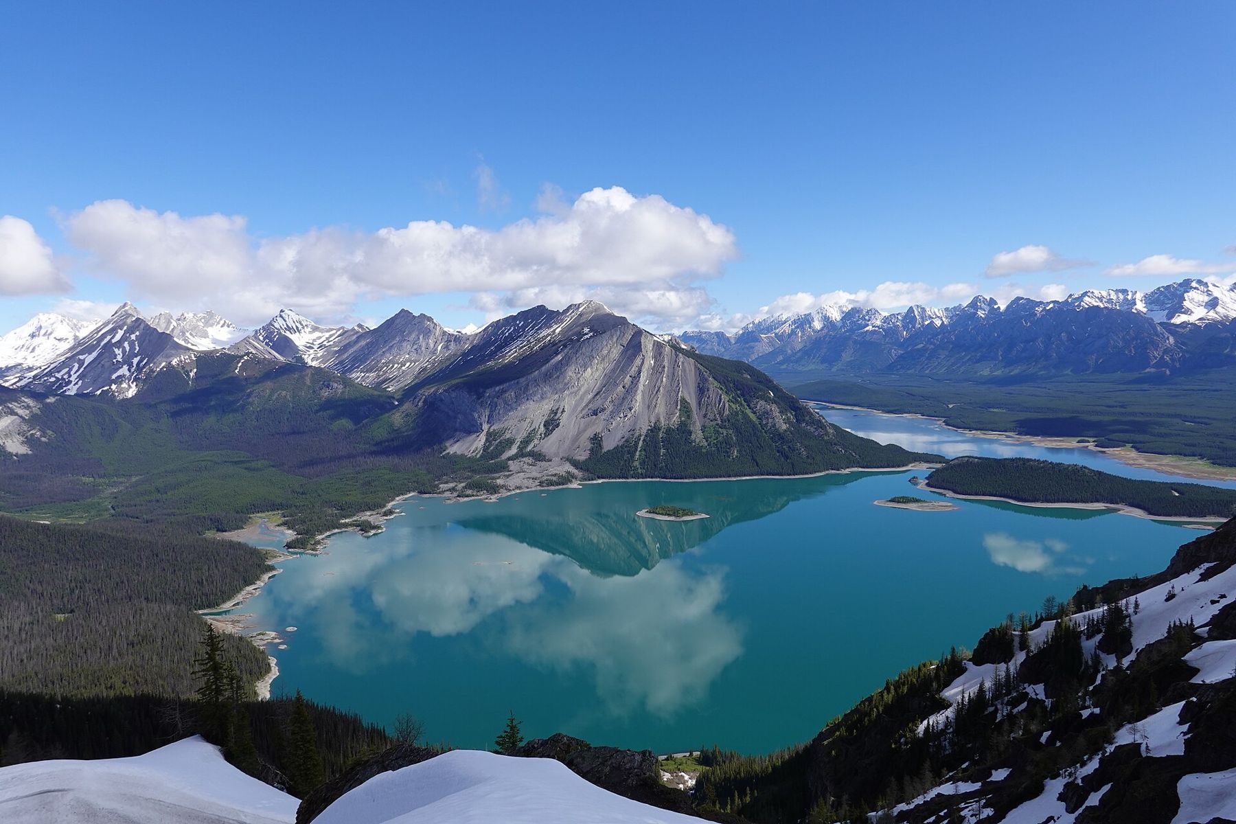
At the southern end of the main Kananaskis valley, before Highway 40 climbs to the Highwood Pass, a side road turns west into Peter Lougheed Provincial Park. It leads to the Upper and Lower Kananaskis Lakes, two large bodies of water set in a bowl of mountains. Both were raised by dams for hydroelectric power in the twentieth century, and they function as reservoirs, but the setting is as dramatic as any natural lake in the Rockies.
The park is a favourite with people from Calgary for hiking, paddling and camping, and on summer weekends it is busy. Midweek, and in early autumn, it is far quieter, and on a still September morning you may have a whole stretch of shoreline to yourself.
Getting into the park
Kananaskis Lakes Trail leaves Highway 40 a short distance north of the Highwood Pass closure gate. The paved road runs past the park visitor centre and several campgrounds to day-use areas on both lakes. A Kananaskis Conservation Pass is required for vehicles stopping here.
The visitor centre has information on trails, current wildlife closures and conditions. Bear activity in the park is frequent, and trails close at short notice when grizzlies are feeding nearby. Check before you set out.
The Upper Lake and its shoreline
The Upper Lake is the larger and more dramatic of the two, with steep peaks rising from its shores. Mount Indefatigable dominates the view to the north, its cliffs plunging towards the water. A steep trail climbs its lower slopes to viewpoints over both lakes, but it is often closed for bear activity in late summer. A trail circles the lake, about 16 km in all, with sections through forest, along rocky shoreline and across open slopes of fallen rock.
The full circuit is a long day, but shorter sections make good half-day walks. The stretch from the Upper Lake day-use area along the southern shore to Sarrail Falls, a cascade on a creek running into the lake, is easy and rewarding.
Also on Highway 40The Highwood Pass: Alberta's highest paved road, open half the year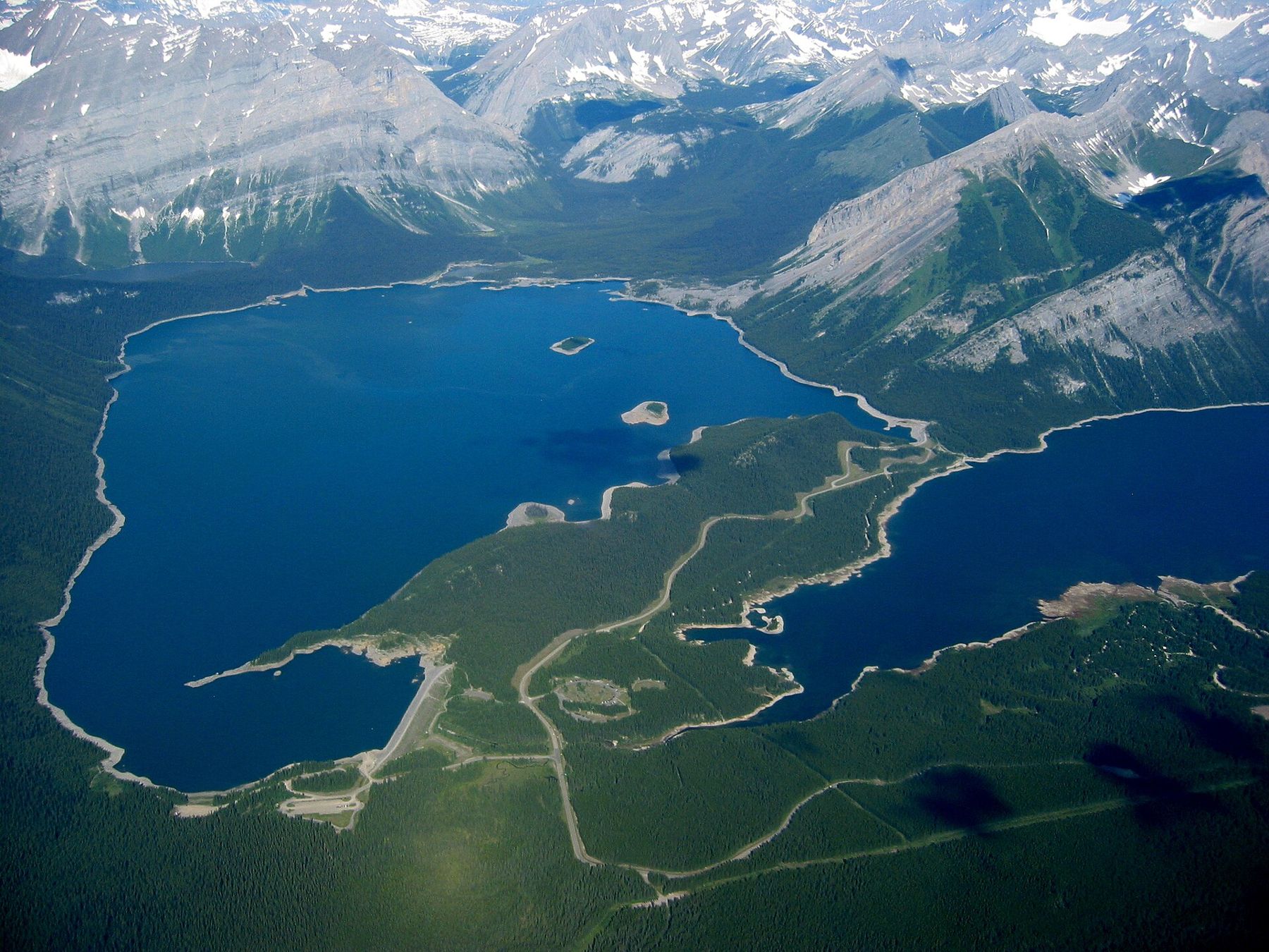
Rawson Lake, up above
From the shoreline trail near Sarrail Falls, a steeper path climbs about 3.9 km through forest to Rawson Lake, a small, clear lake in a cirque beneath the cliffs of Mount Sarrail. The climb gains a few hundred metres and takes most people an hour or two. The lake is quiet, surrounded by meadows and steep walls, and the trail is a popular half-day outing in summer. In early season, snow lingers on the upper path and avalanche danger can persist on the slopes above the lake.
The Lower Lake and paddling
The Lower Lake is smaller and more sheltered, with forested shores and views of the peaks to the west. Its shoreline is easier to reach from the road, with several picnic areas and a boat launch.
Both lakes are popular for canoeing and kayaking, but the water is very cold even in midsummer, and wind can come up quickly, raising waves strong enough to swamp a small boat. Stay close to shore, wear a life jacket and get off the water at the first sign of wind. Motorboats are restricted on both lakes; check current rules.
A changing shoreline
Because the lakes are reservoirs, their water levels rise and fall through the year as water is held back or released. In spring and early summer, levels are often low, leaving wide bands of bare shore and exposed stumps. By late summer the lakes are usually fuller. The effect is unusual and sometimes striking, especially when old tree stumps stand above the waterline, relics of the forest that grew there before the dams.
Camping, picnics and staying the day
Peter Lougheed Provincial Park has several large campgrounds near the lakes, run by the province and popular enough that summer weekends are booked well ahead. Day-use areas with picnic tables, toilets and lake access are spread along both shorelines, and some have shelters for wet days. Fires are allowed only in designated fire rings, and fire bans are common in dry summers; check before you light anything.
The paved Lodgepole and Rocky Mountain cycling paths connect the campgrounds and day-use areas, so you can leave the car in one place and explore on two wheels. The paths run through forest and along creeks, with gentle climbs and plenty of places to stop.
In winter, the park becomes a centre for cross-country skiing and snowshoeing, with groomed trails near the visitor centre. The lakes freeze solid, but ice conditions on reservoirs are unpredictable because water levels change underneath; do not walk on the ice.
Wildlife and weather
Peter Lougheed Provincial Park is prime grizzly habitat, and black bears, moose, elk and bighorn sheep are common. Carry bear spray on all trails, make noise, and follow any closure notices. The roads in and out of the park are also places where animals cross and linger.
Weather here is mountain weather. Sunny mornings can turn to thunderstorms by afternoon, and snow is possible at the higher trailheads in any month. Carry layers and be prepared to turn back. Mornings are often calm on the water, with reflections of the peaks in the Upper Lake, and the wind tends to rise after midday. For a longer drive, the Highwood Pass is just to the south when the road is open.