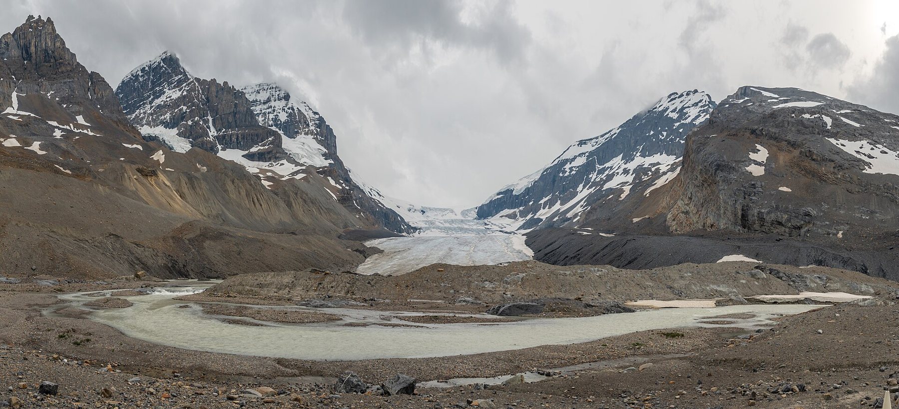
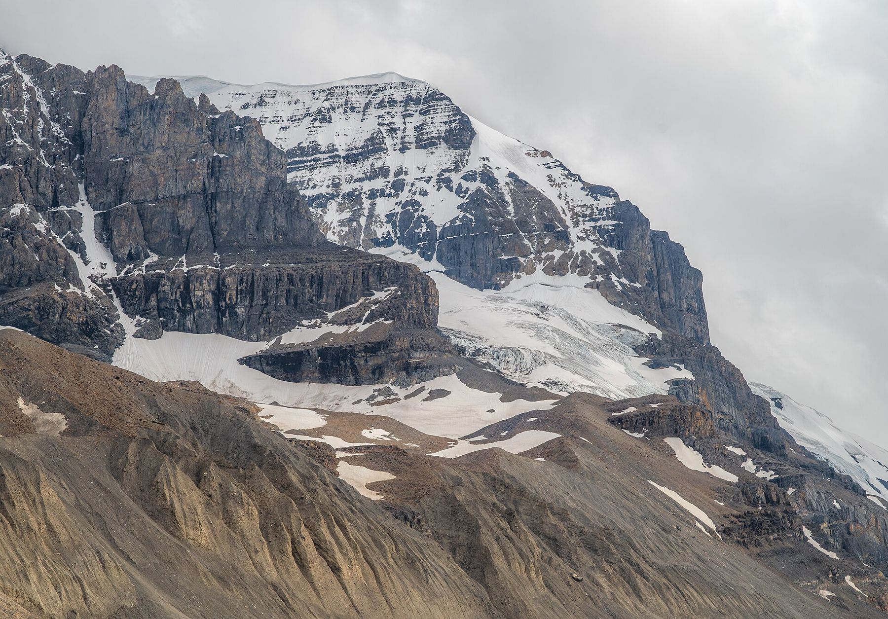
The Athabasca Glacier is one of the few glaciers in the world you can reach in a few minutes from a paved highway. It flows down from the Columbia Icefield, the largest body of ice in the Rocky Mountains, between Mount Athabasca and Mount Andromeda, and ends in a grey tongue of ice above a small meltwater lake. From the Icefields Parkway it looks close enough to touch. That is part of the danger.
A short trail runs from a car park near Sunwapta Lake up across the bare rock the glacier has left behind. It is about 1.8 km there and back, with a steady climb, and takes most people an hour including time at the top. It ends at a viewpoint near the toe, behind a line of rope and signs. Going past that line is both prohibited and genuinely deadly.
The posts that count the years
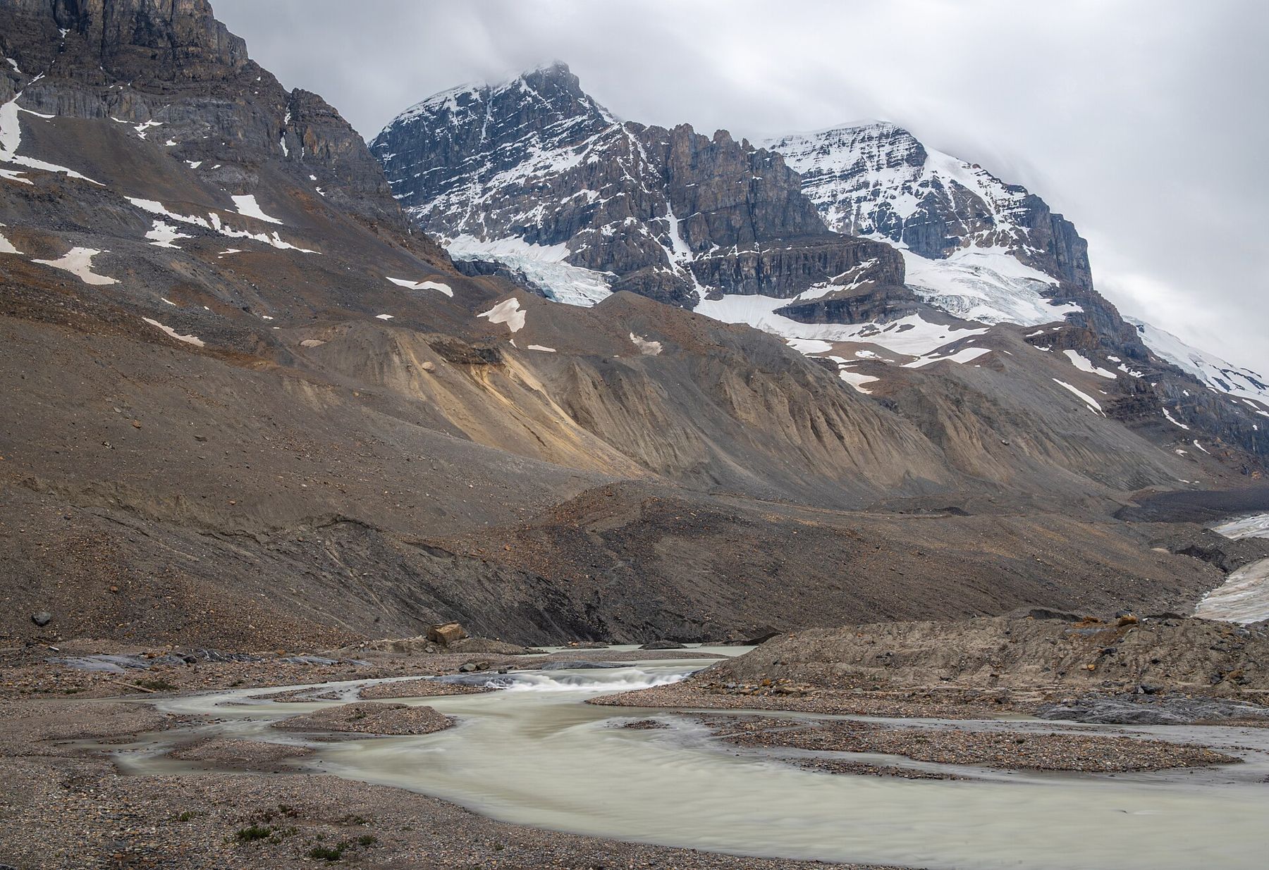
The road to the trailhead and the trail itself are lined with small markers carrying dates. Each one shows roughly where the toe of the glacier stood in that year. The first ones are down by the parkway, which gives a sense of scale before you even leave the car. Walking uphill from marker to marker is walking forward in time. The gaps between them are uneven: some decades the ice pulled back slowly, and some decades it retreated fast.
Taken together, the posts show the glacier has lost well over a kilometre of length since the late nineteenth century, and it continues to thin and shrink every year. The rocky ground you cross on the trail was under ice within living memory. Look at how little grows on it: lichens and a few low plants are only just beginning to colonise the gravel.
The ridges of rubble running parallel to the trail are moraines, piles of rock pushed and dropped by the moving ice. Some of the boulders were carried down from the mountains high above the icefield and left here when the ice melted around them.
Why the rope line is there
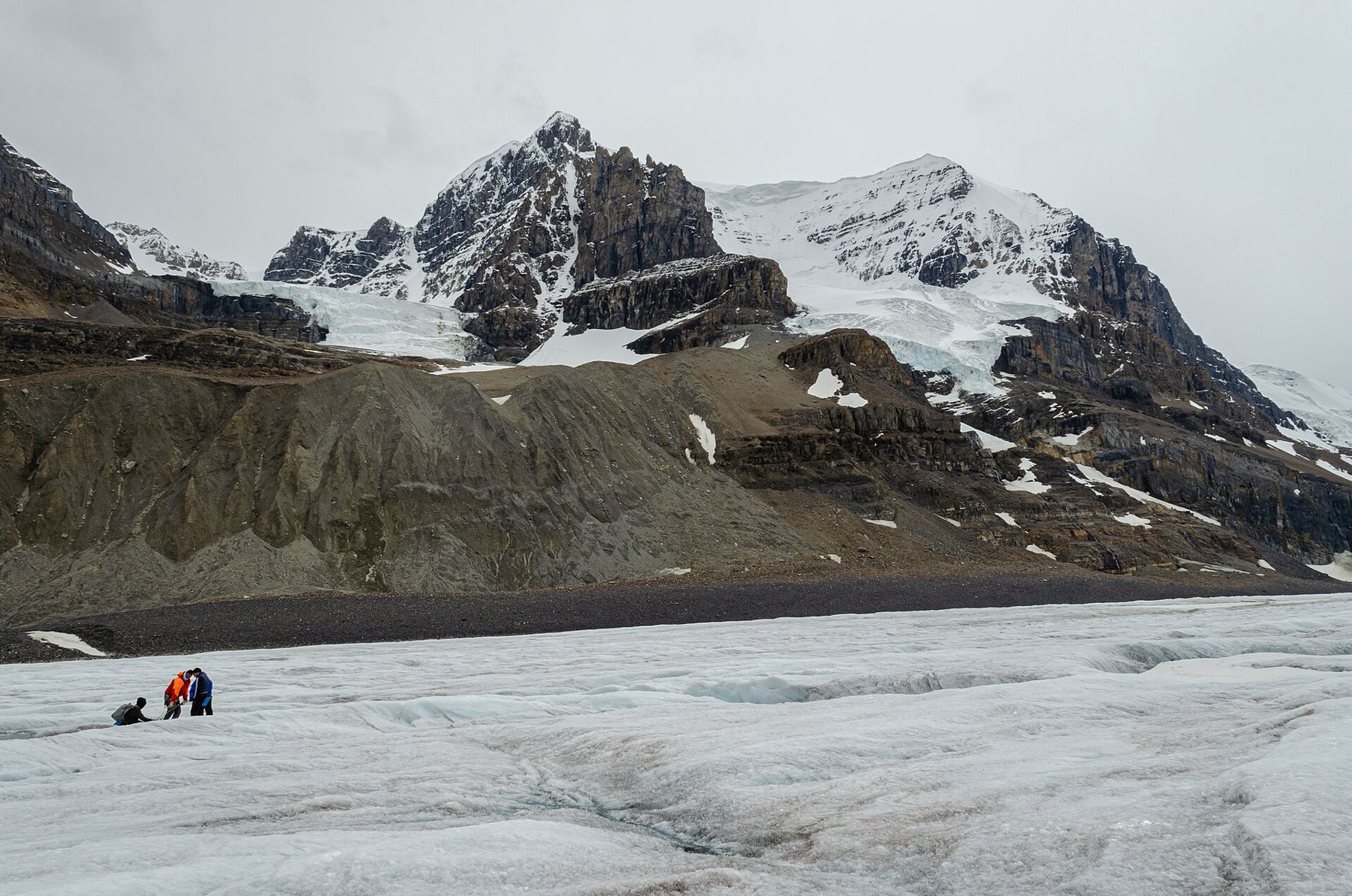
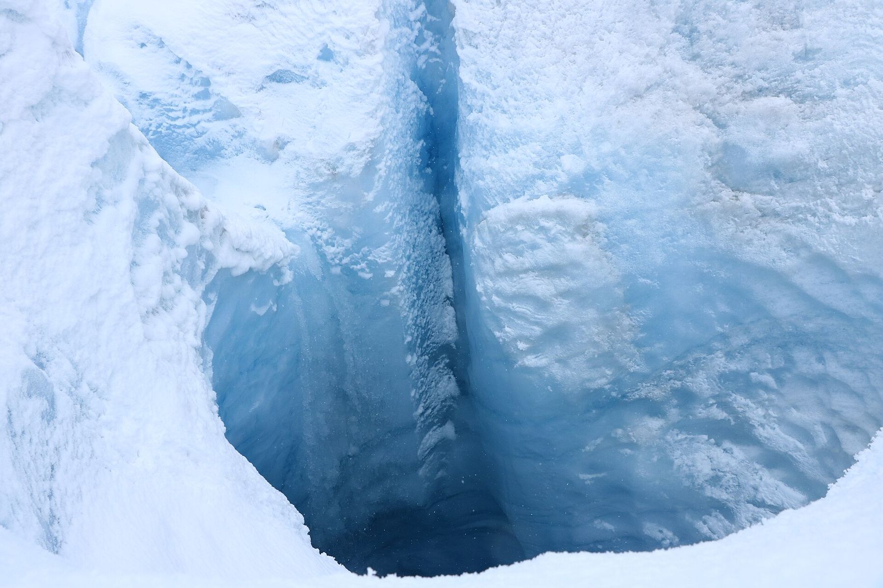
Close up, the edge of the glacier looks like dirty snow. It is not. Under a thin crust the ice is cut by crevasses, some of them hidden by bridges of old snow that will not hold a person's weight. Meltwater carves vertical shafts called moulins that drop straight down into the glacier. People have fallen into crevasses here and died, including in places that looked smooth and safe from a few metres away.
The only safe ways onto the ice are with a qualified glacier guide on a roped walk, or on the commercial snow-coach tours that drive onto a prepared section of the glacier from the visitor centre across the road. Both are seasonal and both should be arranged in advance. On your own, the toe viewpoint is the end of the trail.
Also on Highway 93How to drive the Icefields Parkway in one day without rushing itThe Columbia Icefield behind it
The Athabasca is only one of several glaciers pouring off the Columbia Icefield, a plateau of ice covering more than two hundred square kilometres along the Continental Divide. Its meltwater feeds rivers that end in three different oceans: the Athabasca flows north towards the Arctic, the North Saskatchewan east towards Hudson Bay and the Atlantic, and the Columbia west to the Pacific. Few places on Earth sit at such a junction of watersheds.
You do not see the icefield itself from the road; it sits on the high ground above the glaciers. What you see are its outlets, the Athabasca, the Dome Glacier to its right and the hanging ice on Mount Andromeda, all of them visible from the trail on a clear day.
Reading the ground on the way up
The trail crosses some of the youngest land in the Rockies, and it is worth reading as you climb. Near the bottom, where the ice left longest ago, there are mats of dryas, small willows and the odd stunted spruce. Halfway up, plants become scarce and the gravel is grey and raw. At the top there is almost nothing growing at all. That gradient, from forest towards bare rock, is the order in which life returns once a glacier withdraws.
Look also at the boulders. Many carry scratches running in the same direction, scraped by stones frozen into the base of the moving ice. The meltwater streams beside the path run milky with rock flour, the same fine sediment that colours Peyto Lake further south. Sunwapta Lake below the toe is the first place that silt settles out.
The ground is unstable in places, especially near the streams, where banks of gravel can collapse. Keep to the marked route, which is laid out to avoid the worst of it and is moved from time to time as the ice retreats, so the path you walk may differ from the one in older photographs.
Weather at the edge of the ice
Cold air drains off the glacier constantly, and the wind at the toe can be strong and bitter even on a hot summer day in Jasper. Bring a warm layer and a hat, and expect to need them. Sun reflecting off the ice is intense, so sunglasses help. Clouds can come down fast; if the peaks disappear, the view is gone for the day and it is better to move on than wait.
The trail is rough and uneven, with loose gravel on the steeper parts. Sturdy shoes are enough in summer. In early June the upper section can still carry snow, and by late September the first snowfalls arrive. Outside those months the walk is not maintained.
Walking uphill from marker to marker is walking forward in time.
Fitting it into the day
From Lake Louise the icefield is about two hours of driving, more with stops; from Jasper, about an hour and a half. Allow an hour for the toe walk, plus time for the visitor centre on the other side of the parkway if it is open. Many people combine the walk with the two falls further north on the same afternoon, and that pairing works well on the drive to Jasper.
Go early or late if you can. By late morning in July the small car park at the trailhead is often full and the path is busy. In the evening light the moraines turn gold and the glacier glows blue-grey, and the wind sometimes drops.