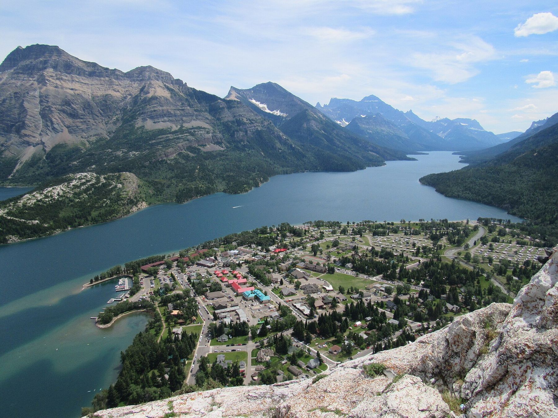
Most mountains announce themselves slowly. You drive through foothills, the ridges grow higher, the valleys narrow, and eventually you are among the peaks. Waterton is different. Coming in on Highway 5 from Cardston or on Highway 6 from Pincher Creek, you cross open prairie, rolling grassland with cattle and wind farms, and then the mountains simply begin, a wall of rock rising almost straight from the grass.
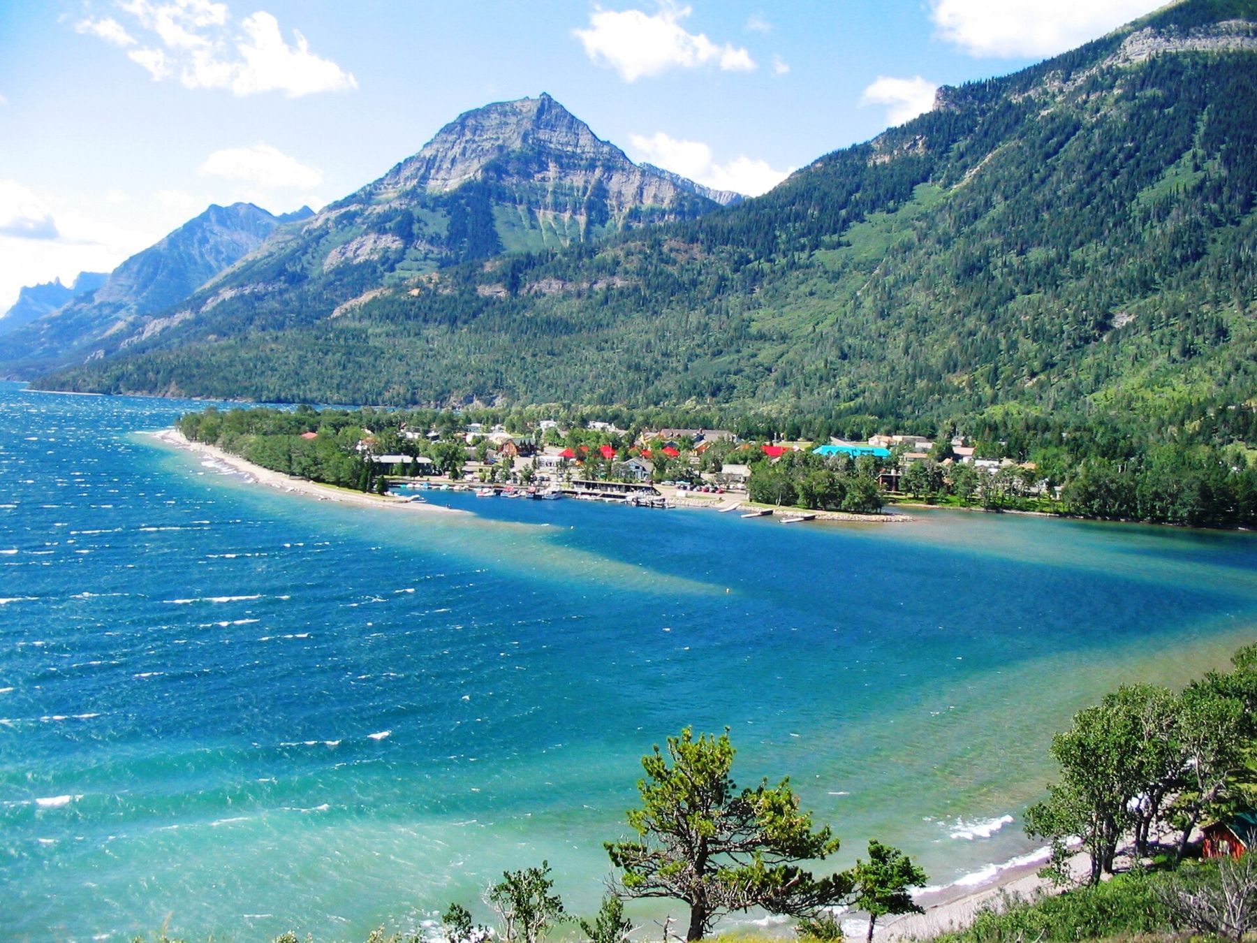
That abrupt meeting of two landscapes is what makes Waterton Lakes National Park special. It is a small park, much smaller than Banff or Jasper, and much quieter. Its heart is a townsite on the shore of Upper Waterton Lake, from which most of what you want to see is a short walk or drive away.
Through the gate
Highway 5 runs west from Cardston across ranch land before swinging into the park. Highway 6 comes south from Pincher Creek and meets it near the park entrance. At the gate, the prairie still runs right up to the road, and the grassland inside the park is part of what it protects: some of the richest wildflower meadows in Canada bloom here in June.
Shortly after the gate, a side road leads to a bison paddock, where a small herd of plains bison grazes against the mountain backdrop. Further on, the road passes the Maskinonge wetlands and the Lower Waterton Lake before reaching the townsite.
Cameron Falls sits on the western edge of the townsite, a short walk from the main street. Cameron Creek tumbles over a ledge of ancient rock in a series of steps. The rock here is some of the oldest exposed in the Canadian Rockies, laid down as sediments more than a billion years ago. Look at the layers in the cliff: the pale and red bands are old sea floors and mud flats.
The falls are lit at night in summer, and the viewing area is just steps from the road. A short, steep path climbs beside them for a view from above.
The deep lake that crosses a border
Upper Waterton Lake is the deepest lake in the Canadian Rockies, a long, narrow trough of cold water that runs south from the townsite into Montana. The international border crosses the lake about two-thirds of the way along, marked by a cleared strip of forest on the slopes on either side. On the other side is Glacier National Park in the United States.
The two parks were joined in 1932 as the world's first international peace park, and together they are a UNESCO World Heritage Site. Seasonal boat tours run down the lake from the townsite; landing on the American side requires border paperwork and is not always possible, so check current arrangements in advance.
Up the Bears Hump
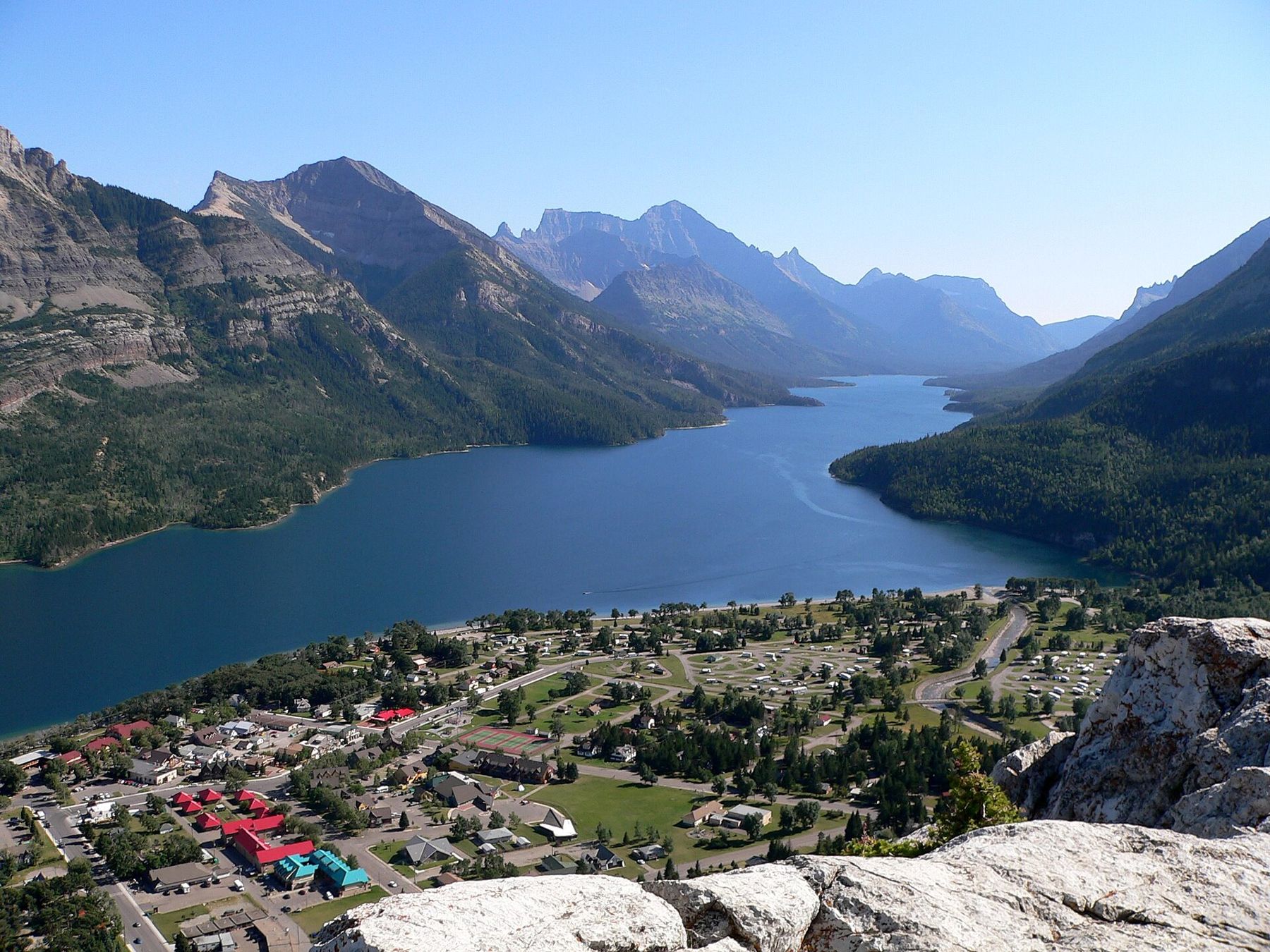
The Bears Hump is a rocky knob on the side of Mount Crandell, directly above the visitor centre at the edge of town. The trail climbs steeply through forest and over rock steps for about 1.4 km, gaining around 200 metres. It takes most people thirty to forty-five minutes going up. At the top, the whole of Upper Waterton Lake lies below, with the townsite on its flat delta and the mountains of Glacier National Park running south into the haze.
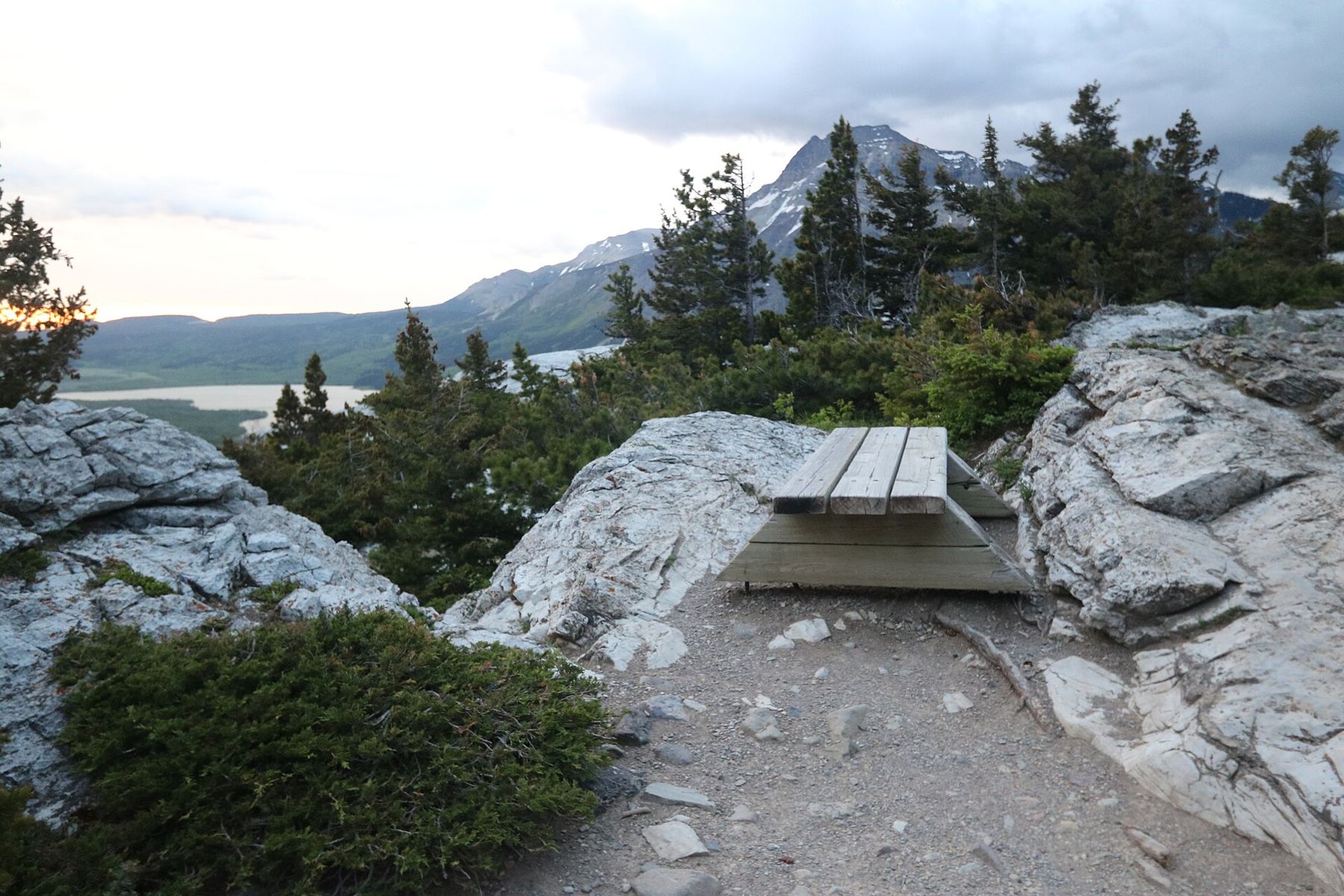
The trail has steep sections with loose rock, but there are benches on the way and the view at the top justifies every step. Hold on to your hat: the summit is fully exposed to the wind.
Wind, fire and the life of the townsite
Waterton is one of the windiest places in Alberta. Strong westerly winds pour through the mountain passes and over the lake, especially in winter and spring, and gusts can be strong enough to rip a car door from your hand or flip a canoe on the lake. Paddlers should stay close to shore and check forecasts carefully.
In September 2017, the Kenow wildfire swept into the park from British Columbia, burning large areas of forest and destroying the park's visitor centre and many facilities. The townsite itself was saved. Much of the park has since reopened, and the burned slopes are regrowing with wildflowers and young trees, a striking sight in early summer. Some trails and roads have taken longer to reopen; check current conditions before you go, especially for the Red Rock Parkway.
The townsite is small and quiet, with a short main street, a lakeside path and a handful of seasonal services. Mule deer graze on the lawns and lie in the shade of the houses, and bighorn sheep sometimes wander through. They are wild: keep your distance and never feed them.
Upper Waterton Lake is the deepest lake in the Canadian Rockies, a long, narrow trough of cold water that runs south from the townsite into Montana.
Wildflowers and the edge of the plains
Because the park spans both prairie and mountain, it holds an unusual mix of plants for its size: more than half of the plant species found in Alberta grow here. In June the grasslands near the gate and the slopes above the townsite fill with colour, with arrowleaf balsamroot, lupines, prairie smoke and, in damp places, wild orchids. Beargrass, a tall plant with a creamy white plume of flowers, blooms in early summer in some years and is one of the symbols of the park.
The best way to see the flowers is slowly, on foot, along the lower trails or the edges of the roads into the park. Do not pick anything; many of the plants are rare in the province. Late June is usually the peak, but the timing shifts by a week or two with the weather, and higher meadows bloom later than the grassland near the gate. A slow walk along the lower slopes of the Bears Hump trail or the lakeshore path often turns up more flowers than a long hike.
Fitting Waterton into a trip
Waterton is about three hours south of Calgary, and it is far from the other parks of the Alberta Rockies. It works best as a trip of two or three days on its own, or as part of a loop through southern Alberta. For walkers there are trails to suit every pace; for drivers, the Red Rock Parkway and the short drive to the bison paddock make a full day without hiking at all. Seen after the larger parks to the north, such as the Icefields Parkway, Waterton's scale and quiet come as a surprise.